17
Feb

Island In The Sky

By: muttler


16/02/2022

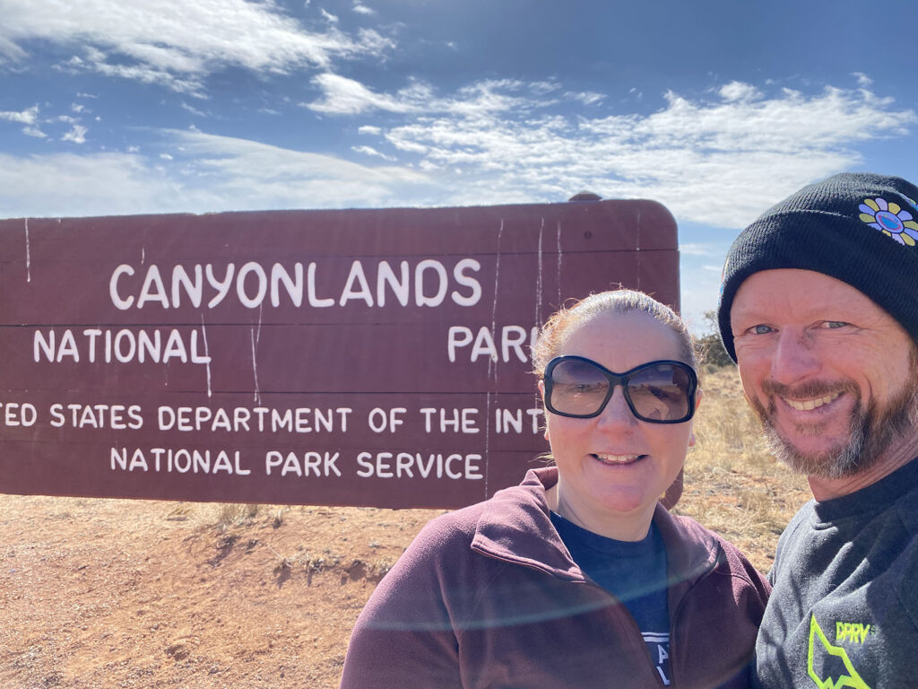
Our first real day in Moab, and it was our first overcast day of the trip. Given we are here in the depths of winter, we have had a charmed run. And when I say overcast, it wasn’t like it was threatening rain or snow. But because of this, we decided to head to Canyonlands National Park, rather than Arches, as Arches was top of Kate’s “to do” list so we thought we would trust the forecast for sunny weather tomorrow.

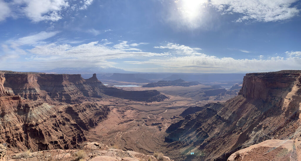
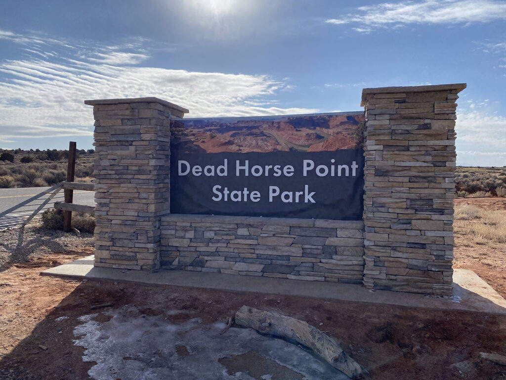
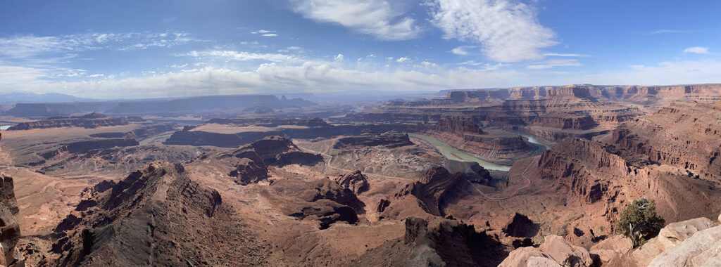
Off we went. Just near Canyonlands is a State Park called Dead Horse Point, and we thought we would wheel in there before heading into Canyonlands proper. Oh boy we were glad we did.

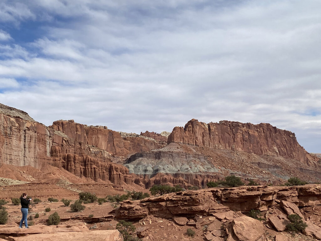
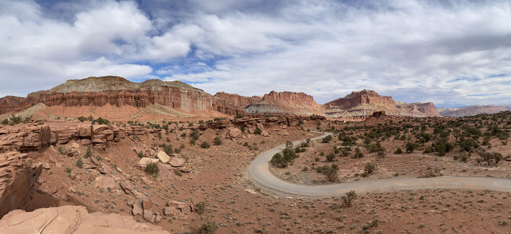
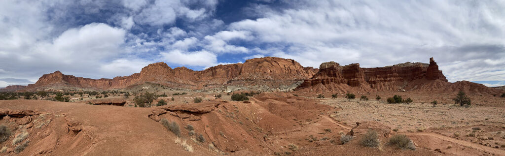
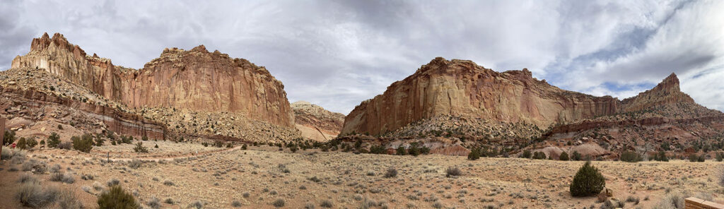
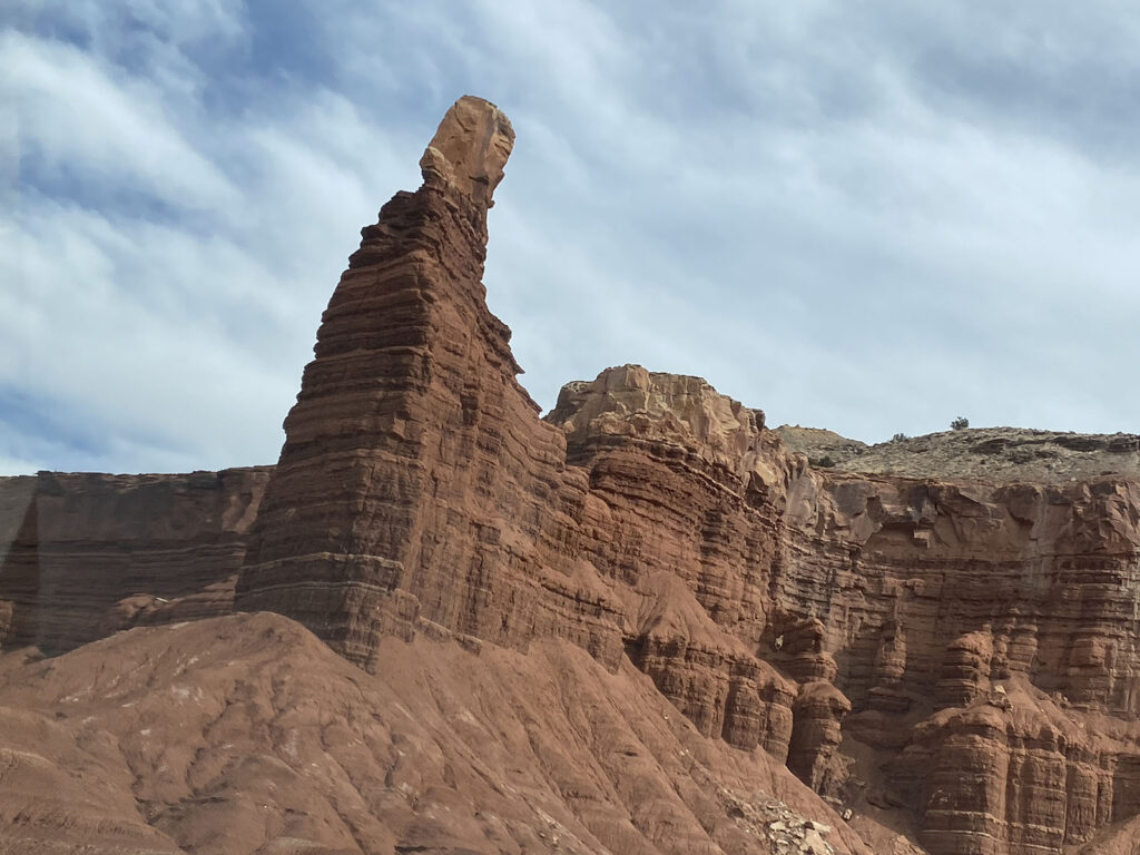
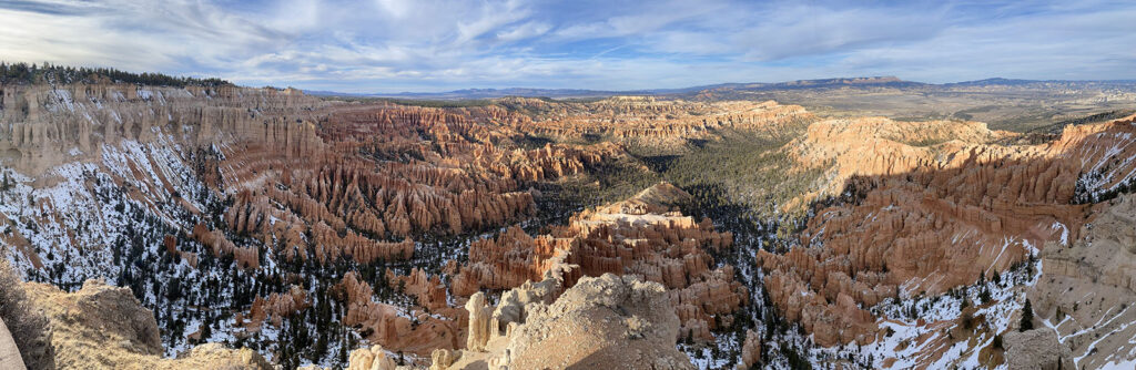
Kate remarked that while Utah is dominated by rock formations, each park had a different feel, and already we felt that this part of Utah was different to Zion, Bryce and Capitol Reef. Here we were surrounded by basically HUGE canyons.


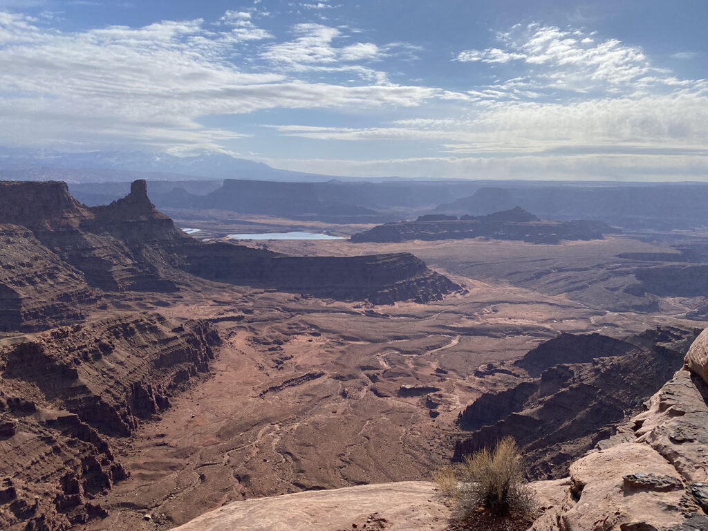
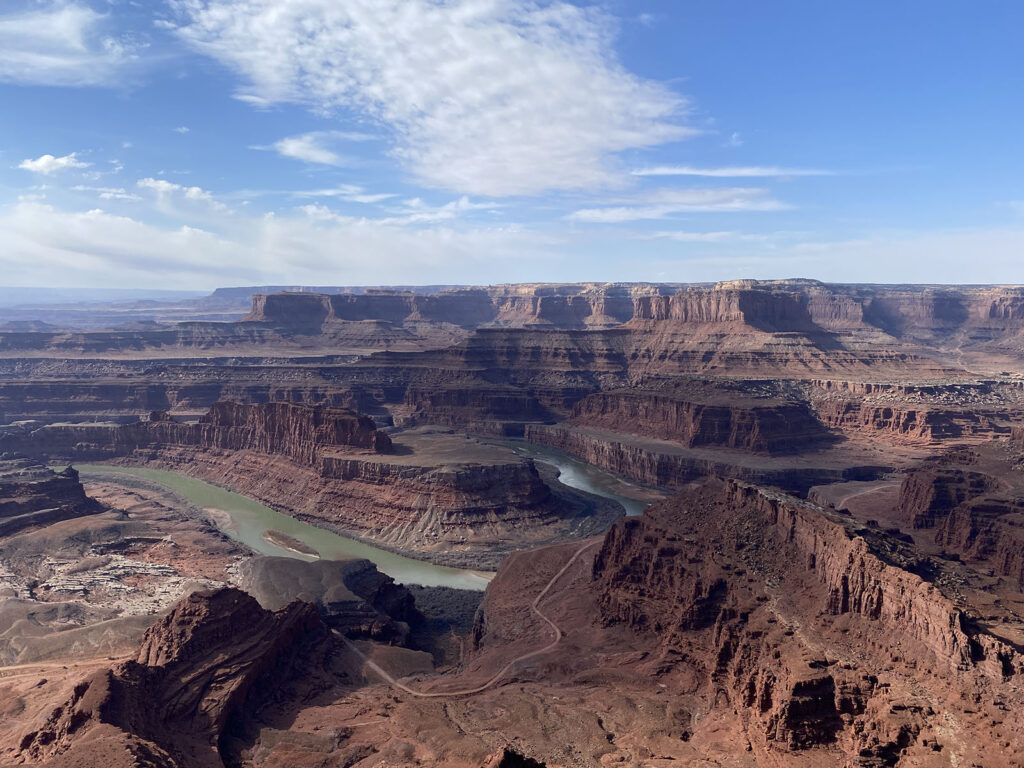
Dead Horse Point, while a very small park, was dominated by a massive canyon and views over the Colorado River, cutting its way through the landscape. Stunning.

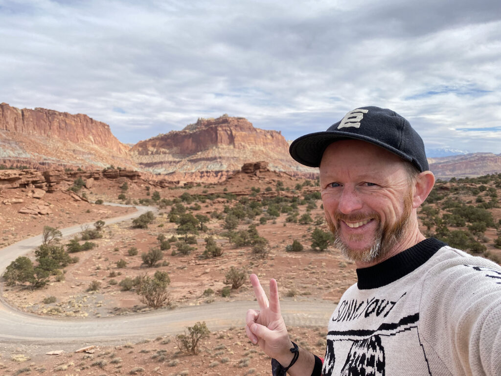
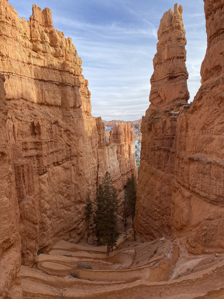
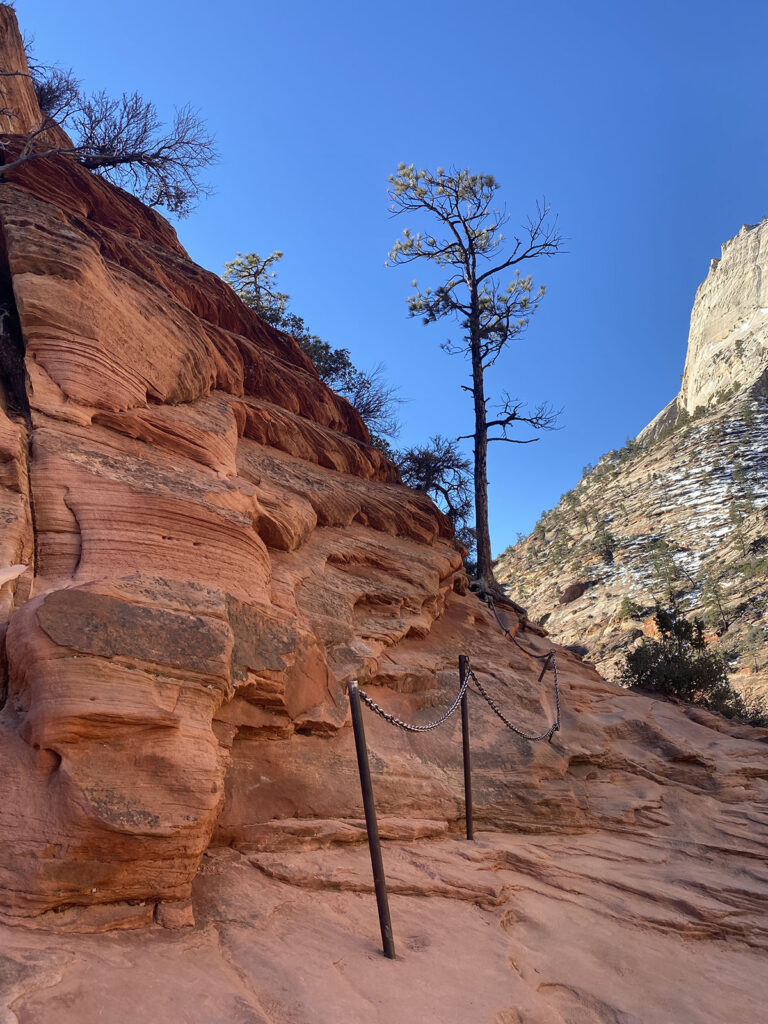
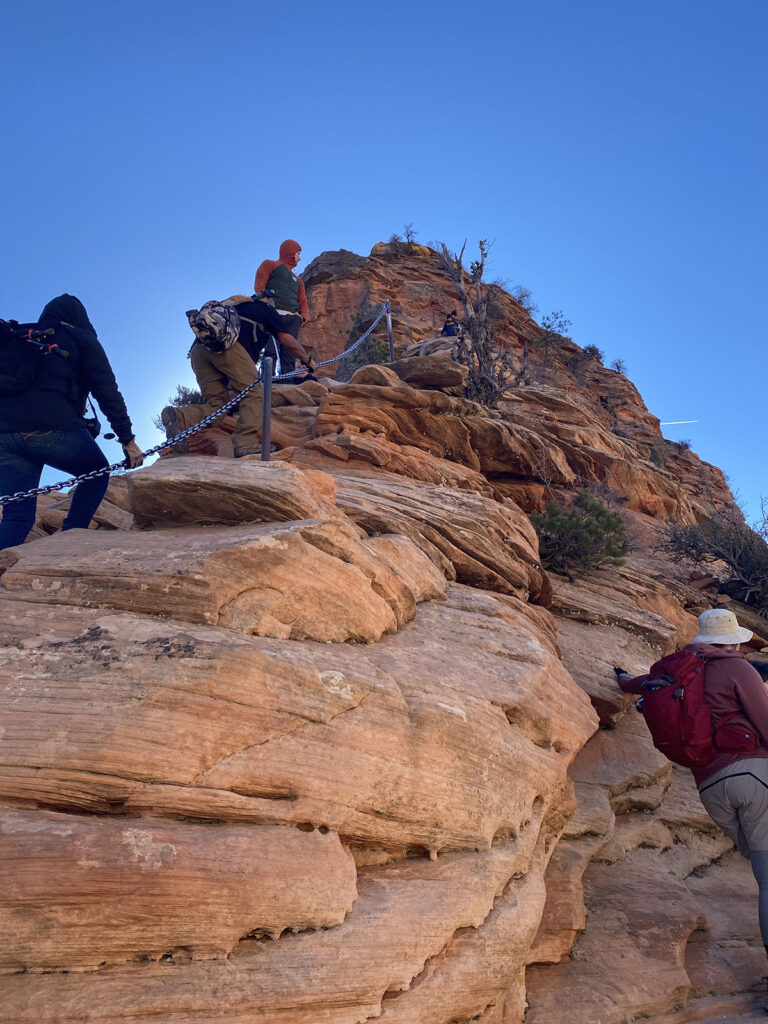
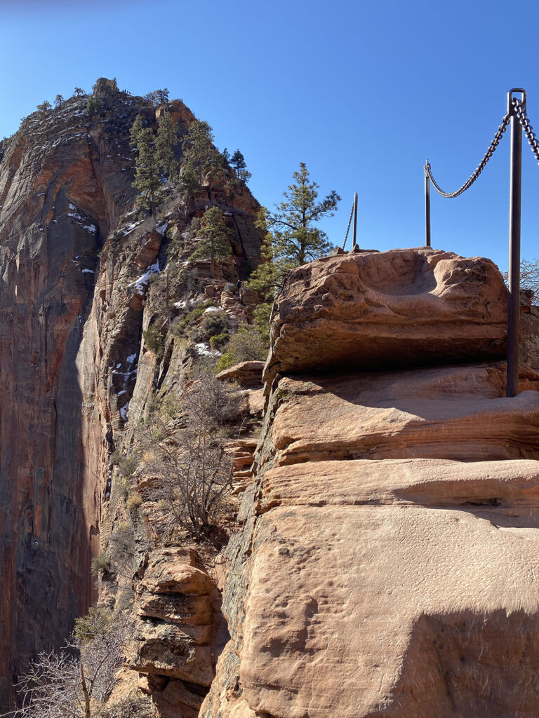
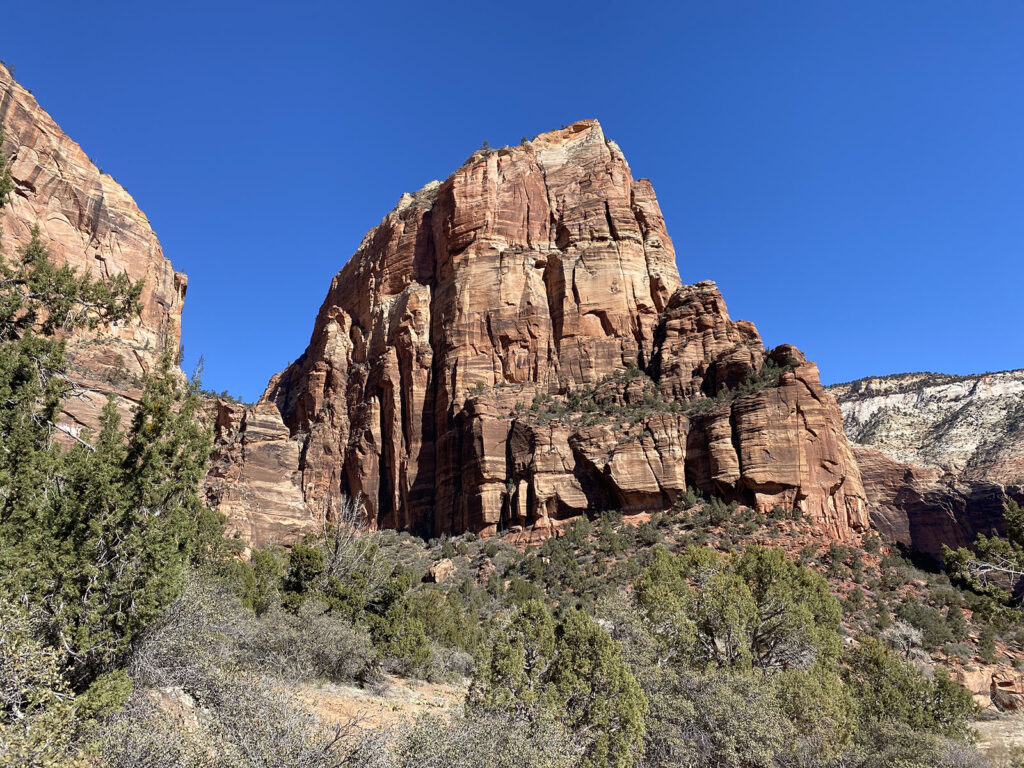
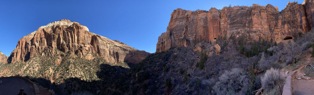
From there it was into Canyonlands. Like I mentioned, this park had a very different feel to the others. Zion you are in amongst huge cliffs and you get to hike in and up them. Bryce was all about the spectacular views of the hoodoos and then hiking amongst them. Canyonlands though, it was all about being on an “Island In The Sky” and looking down on the canyons.


In fact, Island In The Sky was the name of the area we were in. Canyonlands actually is made up of 4 separate areas, and the one we were in was the most visited. We were on a flat of land in the middle of a number of canyons, in part formed by the Colorado and Green Rivers. So it made for a very different experience.


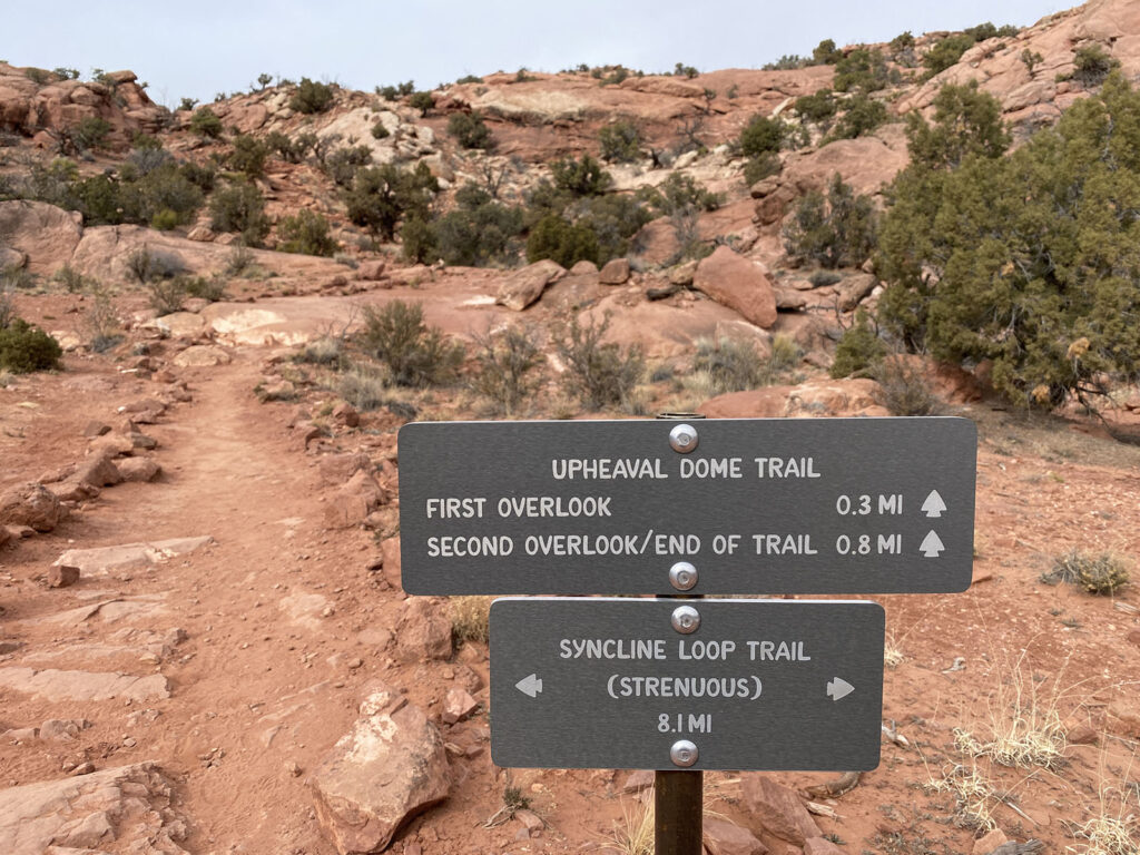
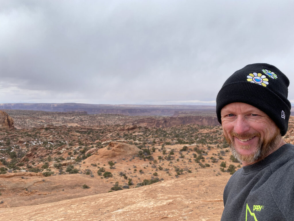
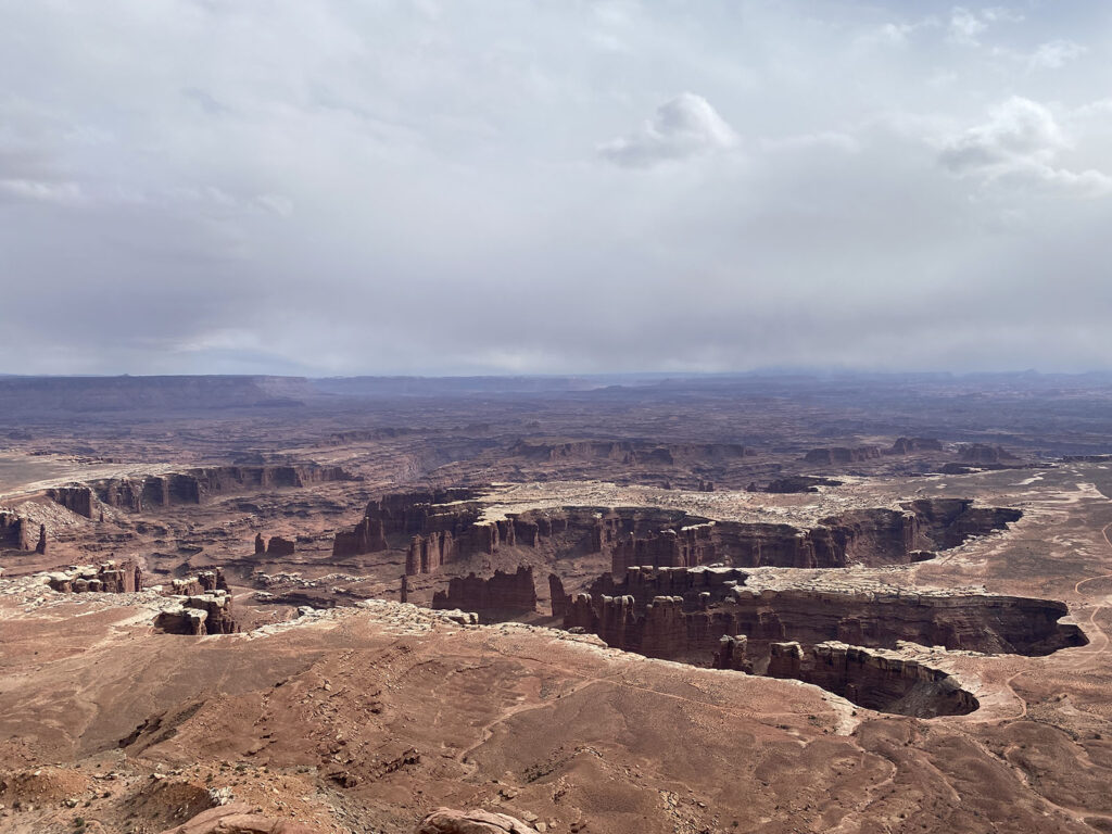
The park consists of several scenic drives, each with their own viewpoints and short hikes. The first hike I did was to the two outlooks for Upheaval Dome, which rather than be a dome sticking up out of the ground was actually more of a crater, of somewhat unknown origin. While not as spectacular as the crater of Death Valley, the second outlook gave me not only amazing views of the crater, but also the other canyons.


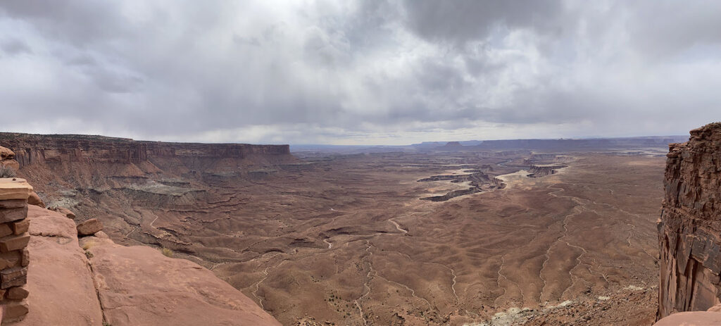
The rest of the day was mostly driving the scenic roads, with stops for viewpoints or short hikes. These included along the rim at some points to give unique views at every turn.


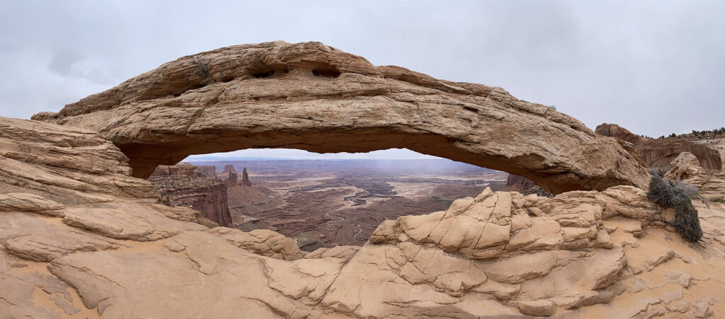
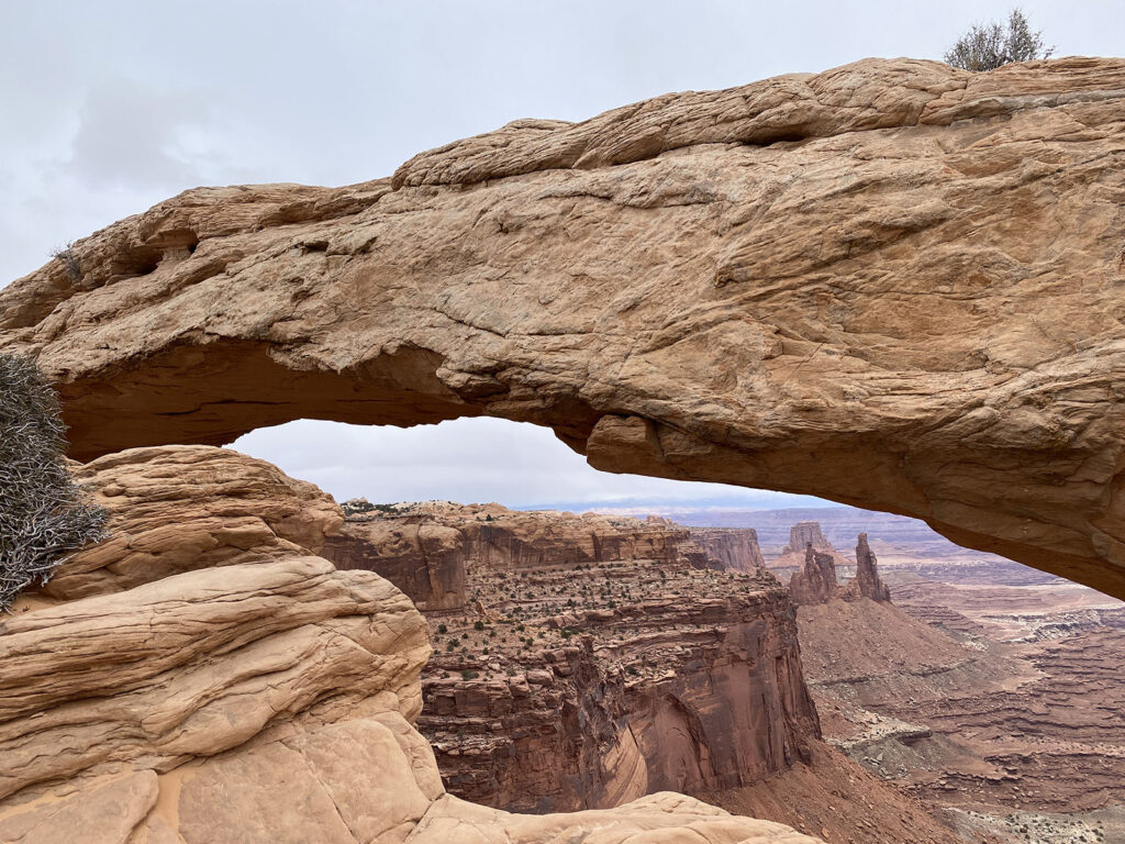
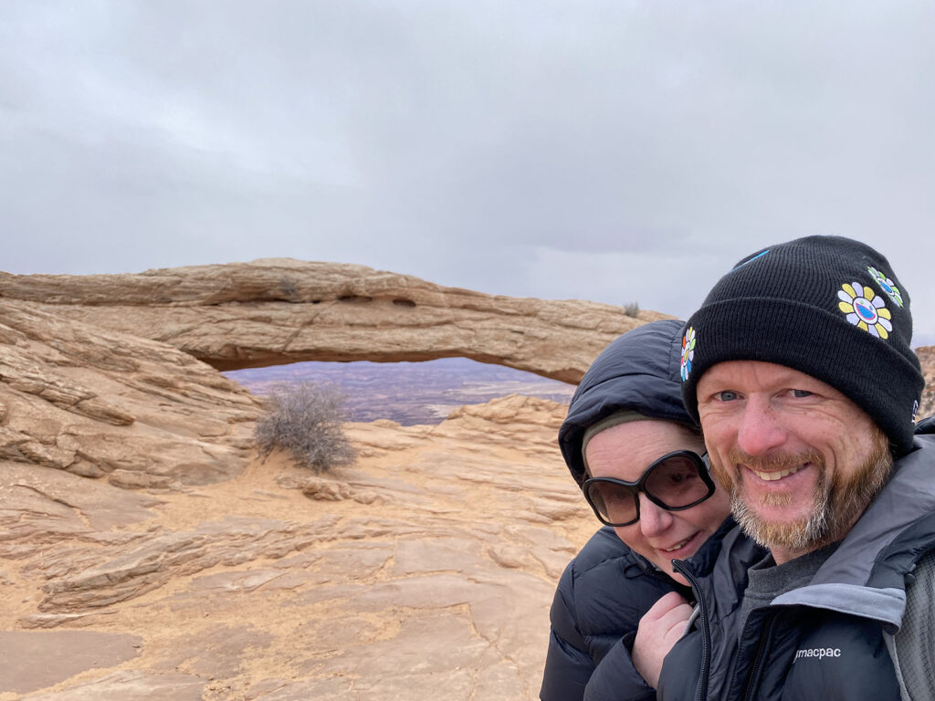
Another feature of Canyonlands is Mesa Arch, a short hike to a rock formation of a large arch, that not only was stunning itself, but very picturesque views through. It was spectacular but thought it may just be an entree for our visit to Arches National Park tomorrow.

It was only mid-late afternoon, but the weather had come in. In fact we were getting light snow on us! So having done the main sights, we decided to wander out of the park, lest we get stuck in the fog and snow. Besides, tomorrow would be a big day in Arches.


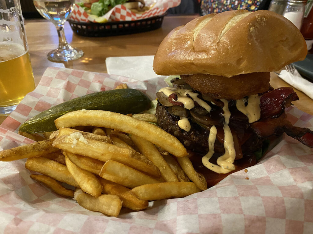
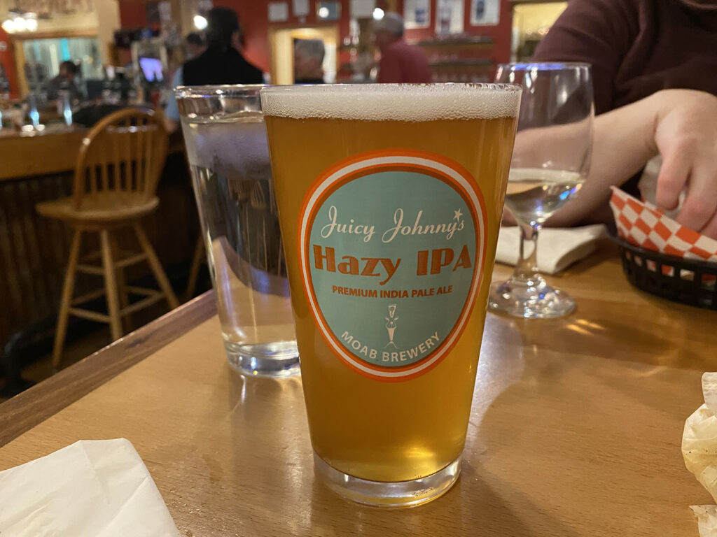
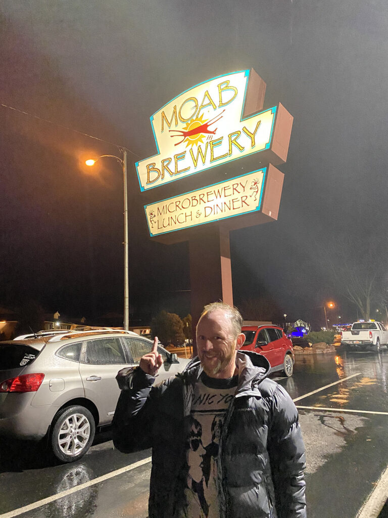
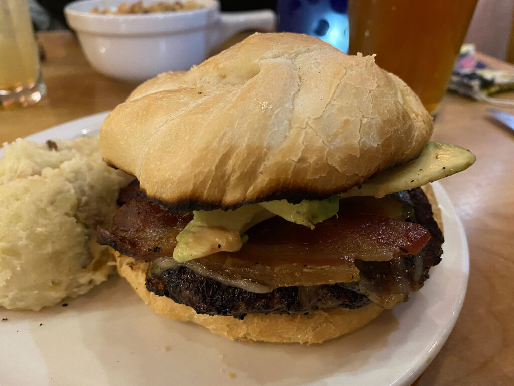
For dinner I strong-armed Kate into a visit to the Moab Brewery. A MASSIVE burger and a couple of pints later (a couple of IPAs) and we were done for the day. Time to rest for tomorrow.

16
Feb

Taking The Scenic Route

By: muttler


15/02/2022

Today was a fair driving day, needing to get from Kanab to Moab… all the way across the other side of Utah.

We had originally planned to hoof it on some of the major roads, however Kate proposed a different idea. How about we take the scenic route? It would only add another half an hour on, but would also take us through Capitol Reef National Park. Of course, let’s do it! Capitol Reef was not on our original plans, as it is quite small and a little out of the way. But now it was in the way, so was a good excuse to pay it a visit.


We said farewell to Kanab and headed off, back toward Bryce Canyon, but then heading further north. It was amazing the changing landscapes we had today. Within half an hour we went from the familiar red rocks, to snowy landscapes. Ah! So this is why we were warned about driving in Utah in winter! Thankfully for us it had been quite a mild, dry spell, so the roads were nice and easy and trouble free.


After about 3 hours of driving, 1.5 of which were in snowy landscapes, we were back in red rock territory. Capitol Reef is a sneaky one, as you don’t “enter” the park like the others… you literally drive through it as part of your normal travelling!

Once you are in the park, there are then some sights signposted, giving us perfect vistas that we were not getting sick of.


The main difference is that when you hit the Visitors Centre, you can pay the park fee to drive the 10 mile scenic road. Given we had our National Parks Annual Pass, we flashed that and meandered down the scenic road, stopping for pics and then some lunch.


We didn’t partake in any of the hikes. There wasn’t any that were key ones to do, and we thought it best to get back on the road. On the way out we got to see some petroglyphs dating from between 600-1300 AD. Sadly they were slowly disappearing through erosion and natural rock falls, but given a number had lasted 1500 years already, they were likely to be around a little longer!


The drive continued to stun us. We went from the red rocks to strange, grey landscapes. Completely natural, but in some ways they looked like they were the result of mining or something, given the ashen colour.

But soon enough the red and brown vistas came back, as we got off the smaller road we were on and back on to an interstate. Barreling along at 80mph (yep, about 130kph) were were in Moab in no time.

Moab was a bit bigger than Kanab, but much more of a tourist town it seemed, with Arches and Canyonlands National Parks within half an hour of the town (Arches only 10 minutes away). Rather than explore we decided to chill after the long day of driving. More parks tomorrow 🙂

15
Feb

Hoodoo Voodoo

By: muttler


14/02/2022

Today was Bryce Canyon day!

We headed off nice and early on the 1.5hr drive to Bryce Canyon National Park. We were really looking forward to this one as photos we had seen were stunning.

A fairly quiet drive was made exciting by the proper arrival of SNOW! As we got within an hour of Bryce, we found the ground covered in snow. The roads were all fine, but it was delightful to see the white dusting all the landscape.


We drove into the park, and made our visit to the Visitors Centre. Unlike the previous two days at Zion, it seemed deathly quiet. There were very few cars around and we got the sense that we would be lucky to see a dozen other cars in the park. After getting our bearings and maps and things, we headed to one of the main view points of the famous Bryce Canyon Amphitheatre.


Holy moly.

It is incredible how similar, but also how vastly different the landscape and parks can be here in Souther Utah. Unlike Zion, which was magical and dramatic cliffs, with myriad hikes, Bryce Canyon was different.

The amphitheatre is a mind blowing canyon full of “hoodoos”… massive upright standing red rock formation. The hoodoos come from bigger rock formations that erode, giving a dramatic canon full of tall red soldiers. From above it looked immense.

We wandered along the rim for a while, trying to view the canyon from different angles, each catching the rising sun in different ways.

Today was going to be quite different to Zion… more about sightseeing in a way, more so than hiking. Bryce has one main scenic road that you can drive up and down, with about a dozen viewpoints along the way. Each would give a different view of the canyon and its hoodoos.


There was also some more unique rock formations, like Natural Bridge… a massive rock eroded by water to form a bridge like formation. The shapes, the colours… all was unbelievable.


So we spent the good part of a few hours doing the scenic drive, soaking in all the different views. There was also time for snowball fights 🙂


From there we went to something different. Mossy Cave is off the scenic drive, down at canyon floor level,  and offers an alternative to the canyon. A short hike along a river leads to a small cave. In summer it has flowing water, but in winter it is full of icicles and frozen mini waterfalls. It was nice diversion from the drama of Bryce Canyon.


From here, I embarked on a 1.5hr hike down into the canyon. From the main Sunset viewing point, you could head straight down into the canyon, and hike amongst the hoodoos. It is remarkable how different it felt. From above, the canyon seems huge and almost impenetrable. But hiking into the canyon it becomes more intimate, as you wander amongst the hoodoos and other formations. It was amazing to just wander the trail down on the canyon floor, looking up at the formations.


A strenuous hike back to the top, I met Kate and we visited our last sightseeing spot, Bryce Point. We probably saved the best for last, as it was stunning, and with the sun starting to set it presented us with some final stunning imagery.


With the sun going down we headed back for our last night in Kanab, before we get moving again tomorrow. We finished the night at the local restaurant. Burger challenge… not too bad… pattie a bit overcooked, but the pickle and mashed potato was a nice side touch!


Oh, and a bonus photo… Kit Kat I picked up yesterday after getting a heads up from my mate Craig that they were floating around in the US 😉

14
Feb

Angels Landing

By: muttler


13/02/2022

We factored in a “play it by ear” day within our stay in Kanab. It could be for visiting a park again, something else in the area, or even just resting. But I don’t rest. Sadly, it is not something I really have in me. Kate is happy for a lie in, but me… I’m awake by 6am and happy to be doing something not long after that. So today, was a tale of two halves.

I decided to head back to Zion National Park and do the one hike I couldn’t do yesterday… the epic Angels Landing. Kate was content to rest for the morning, so just before the sun was coming up, I was back in the car.


The drive into Zion was different from yesterday. Today, I was arriving as the sun was coming up, so different peaks were catching the light differently. The reds in the cliffs started popping, while some were an illuminating gold, and others still shrouded in darkness. It was hard not to keep stopping to take sub par pictures.

Given my very early arrival, I didn’t have the same issues getting on the road as we did yesterday. But it was still busy, as when I got to the hike car park, it was all full! Who were these crazy people! So I could go to the next closest, and then it was just a brisk 10 minute walk to the start of the trail.

Angels Landing is THE hike in Zion. It is so popular that apparently from April they are launching a ballot, so that you need to go into a lottery to get a spot to do the hike each day. Along with being the most popular, it is also the hardest (outside the Narrows), highest, and scariest. The gruelling 400m hike on switchbacks gets you to Scout Lookout. That itself is a feat. But then it is apparently a heart-pounding trek up to Angels Landing, with only some well placed chains and your wits to help.

So as the sun was up and the temperature just starting to get above 0, I headed off.


My running in the last 6 months held me in good stead as I was able to power up the main part of the trail. Don’t get me wrong. It was exhausting, but it felt great to get the heart rate up and keep it up there for a solid 45 minutes.

So with not too much difficulty (some icy paths aside) I made it to Scout Lookout. It was glorious up there. It had warmed up a little and the sun was gorgeous. I took some time for a breather and keep the fluids up, and then it was to the tough part.

Tough in two ways. Physically very demanding as it was steep. But more so, it was mentally tough as the path was precarious. On average about one person a year dies on this part of the trail. Yikes.


About 75% of the way up was with a rock solid chain guide. Luckily, as it was often needed to pull yourself up, or to stop slipping on ice. It was also accompanying a VERY narrow trail, rarely wider than a single person. So managing traffic got quite difficult!

I have to admit, there were times that were absolutely terrifying. But in the best way possible. It was a RUSH. I am fine with heights, but to see shear drops on each side was something else.

I kept powering my way up, and after about 45 nerve-wracking minutes I reached the top.

OH. WOW.

It was a rush of emotions. Being right on the edge for 45 minutes. Wrestling with the craziness of it. The exhilaration of reaching the top. THE VIEWS.


But most of all I think it was also the build up fo the last 2 years, where for two whole years, I had not spent a night outside of the house. And the odd day trip aside, had not done anything resembling travel. So to think that after 2 years I was now on a mountain top in Southern Utah, looking down on a very different world… well, it was pretty emotional.

I sat and soaked it up. I got chatting to some lovely folks, in particular a group of friends from all over the US, getting together over their shared love of hiking.

After a little time of self reflection, I started on my way down. Traffic was much greater, and so there was lots of waiting to let people through at times. Down is in some respects harder, but I was full of adrenaline so was just enjoying the rush still on the way down. On the way down I met a lovely couple from California. The lady said the sweetest thing as we headed down. On one part of the path which was quite precarious, there was a lone tree, and one branch had a beautifully shiny and smooth worn branch that I imagine most people grab for support on the way down. Her partner commented on the shininess of the brach, to which she replied, “If it helps, let it shine”. Not sure why I just found that to be the sweetest comment.


I made it back safe and sound to Scout Lookout, and then was able to power down at a fair clip back to the start. I did the wander back to the car, still full of adrenaline.

I had done most the hikes I wanted to now, and so decided to drive around the park and then head out. One other hike that I was considering I had no chance of parking the car, so off I went back to Kanab.

Kate had had a lazy morning and caught up on some sleep. On my return she had done a slight bit of changing to our plans, and thought that today would be a good day to go for a drive to (somewhat) nearby Horseshoe Bend. We had planned to do that on a different day of driving, but it was only about an hour away, and it was only 2pm, so we thought, why not! So after a freshen up, it was back in the car.


Horseshoe bend is part of Glen Canyon (near the end of the Grand Canyon I believe) and is a gorgeous horseshoe shaped carving out by the Colorado River. It is not really much of a hike or anything, rather just a spectacular part of the Arizona (yep, back in Arizona!) landscape. It did not disappoint.

We were about done for the day, so after a stop for some supplies at the Page Walmart, it was back to Kanab. Being Superbowl Day, I caught the last half, before settling in for the night. More parks await tomorrow!

13
Feb

“You Don’t Know Where To Look Do You?”

By: muttler


12/02/2022

Kanab was acting as a bit of a hub for us for a couple of nearby parks, and today was the first. Zion!

I feel quite embarassed now that I thought yesterday’s drive was so amazing. It had nothing on today. As we got closer to the National Park itself, the landscape became more dramatic, colourful and incredible. And when we actually entered the park… it went next level.


The winding road from Kanab (heading into the park from the East) must be one of the great drives. You are greeted with a few miles of winding road where every turn is a new photo opportunity. At one point Kate said to me “you don’t know where to look do you?”, such was my darting eyeballs through every window of the car. To make things even more dramatic, after the incredible winding road, you enter a tunnel a few miles long bang straight through a mountain.

We emerged into more spectacular scenery. So that we could get our day sorted, we popped by the Visitors Centre for a quick stop, before heading to the main scenic road. Because it is considered low season, you can drive it yourself, rather than need to take the shuttle bus.

That is when our plans went a little awry.

It turned out that today was an incredibly popular day to be heading to Zion. So much so that the main scenic drive was temporarily closed because of the amount of traffic and that all car parks along the drive (for the hiking) were full. The guide let us know that it closed at about 10am and was unlikely we could get in there until after 3pm. Oh dear.

After a bit of a downer vibe we picked ourselves up. It wasn’t the end of the world as we had an extra day in the area planned, so looks like it would be back here in the next couple of days! But all was far from lost. We had done the amazing scenic drive in, but also there was plenty more to do. I decided to take one of the more strenuous hikes, the Watchman’s Trail.


It wasn’t too long, but did a couple hundred metres of elevation. When reaching the top there were awesome views off toward the “Watchmen”… the local name for a group of 3 large rock formations that look over everyone.


On getting back down, Kate (who had just been chilling) had discovered a local craft brew pub. Winner! So we popped in there and I had a nice pomegranate sour to replenish after the hike.


Our plans changed a bit given the road closure, so we decided to take advantage and visit a nearby ghost town (our second of the trip) called Grafton. This one had buildings in much better shape than our previous ghost town, although none as impressive as the deserted train station. The cemetery was reminder though that once this was a populous town that fell on hard times.


From Grafton, we headed back into the park. We needed to make our way back out the way we came so we headed off. When we got to the scenic drive it had reopened, so we decided to head up, weaving us through a huge canyon. We got to the end of the drive, and rather than turn around, decided to take the riverside hike. This hike is the main one that leads to the start of one of the most famous hikes, The Narrows, which is a 15km hike along (and often, in) the river through the canyon. It is basically off limits this time of year due to the cold. Maybe next time.


With that, the sun was setting, so it was back to Kanab for rest (saying hello to one of the local goats on the way), with more park magic tomorrow.